52 Ancestors: A Record that Adds Color
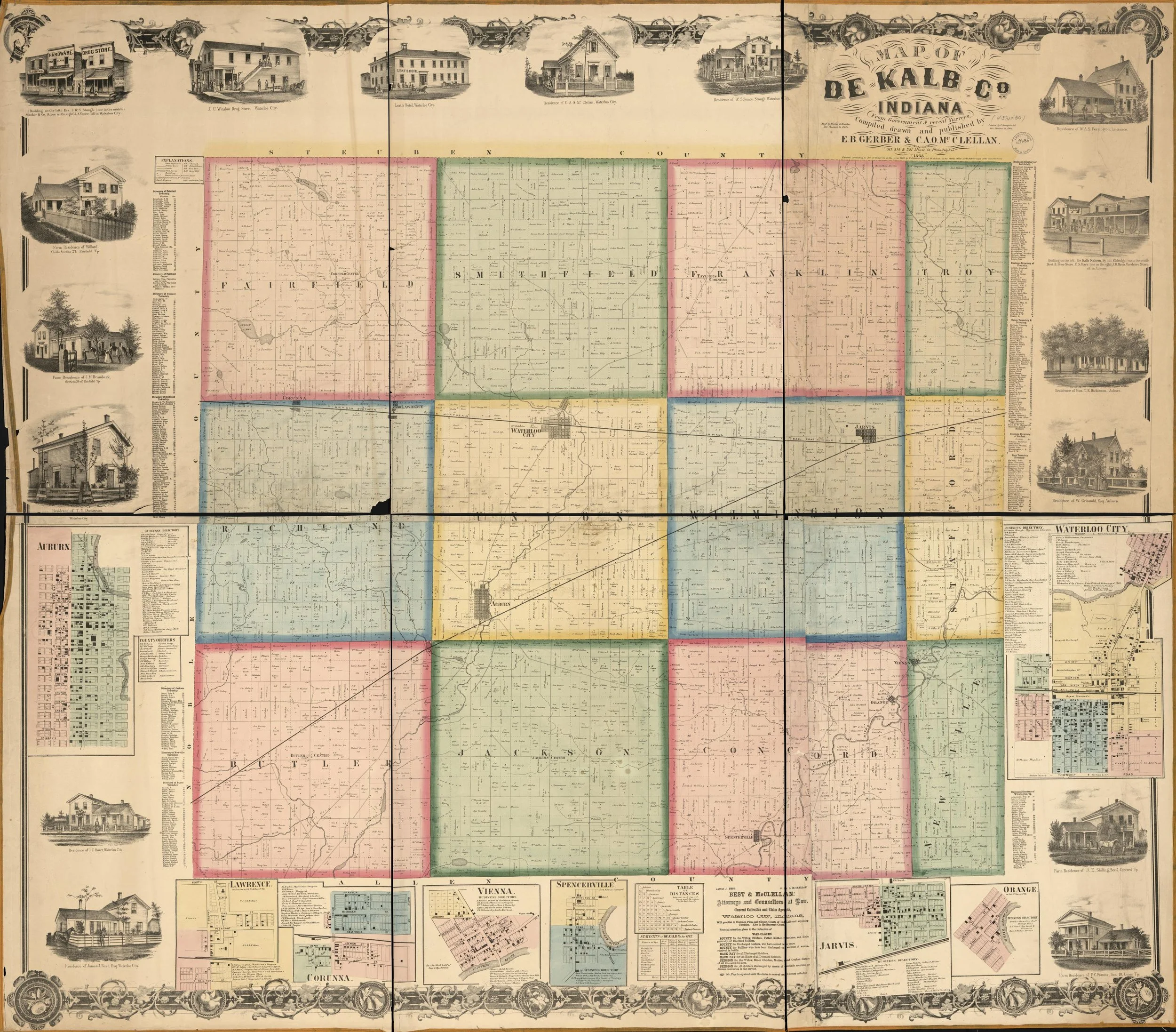
Gerber, E. B, C. A. O McClellan, Worley & Bracher, and F Bourquin. Map of De Kalb Co., Indiana. [Philadelphia: E.B. Gerber & C.A.O. McClellan, Phila.: Printed by F. Bourquin & Co, 1863] Map. https://www.loc.gov/item/2013593194/.
Thinking about the 52 Ancestors in 52 Weeks topic for this week, "A Record That Adds Color," I decided to go a little literal.
This map of DeKalb County, Indiana was created in 1863 (digital is from the Library of Congress), and showcases detailed land ownership in the county at the time. DeKalb County is one of three counties in this area that a branch of my maternal line spent generations living in. As I traced these lines backwards, I found an 1880 map that showed where my 3x great grandfather Andrew Ferrier had land, which was in the top right corner of Fairfield Township, shown here as the pink square in the upper left.
In this map, however, that family wasn't present. But in the detail view of Waterloo City (far right is the detail, but the town itself is at the top of the yellow square in the middle), there is my 3x great grandfather Joseph C. Mead. Mead's son William would marry Ferrier's daughter Ida, eventually leading to yours truly. Being able to compare the 1880 map and this 1863 map and see the relatively close proximity of these two families added a lot of color to my understanding of their lives. Also, William Mead would spend his entire life working for the railroad in this area, so understanding the evolution of the county and railroads in it added rich context to the movements of he and Ida and their children.